The Feel of the Place

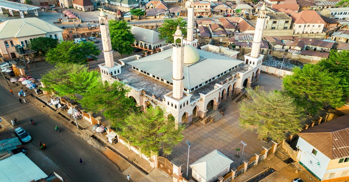
Buta sits quietly in the far north of the Democratic Republic of the Congo, the administrative capital of Bas-Uélé Province and a gathering point for the surrounding forest zone and Zande cultural region (F5-2). The town rests where the Rubi and Uele river systems meet (F4-2), and that setting shapes the rhythm of life here more than any clock. Pirogue traffic along the Uele, the lingering presence of colonial-era railway relics, and the green corridor stretching toward Garamba together give Buta the feel of a place on a threshold, half-tucked into the trees and half-turned toward the road.
The mood is unhurried. Travelers who like places that reward patience over planning may feel at home here, especially those comfortable arranging local guides and river craft on arrival rather than booking every detail in advance.
Weather and Seasonal Context
Buta has a hot climate year-round, with monthly average temperatures that swing from roughly 70°F (21°C) in August up to about 97°F (36°C) in February (F1-2). The town sits at a low elevation of around 402 m (1,319 ft) in the Africa/Lubumbashi time zone, UTC+2 (F1-2). Conditions typically run warm and humid: readings around 23°C (74°F) are common, with humidity that often sits near 89% and light winds on the order of 3 km/h (F2-1, F2-2). The combination of heat and moisture can feel heavier than the thermometer suggests, so visitors who prefer milder temperatures may want to plan active outings for the cooler parts of the day.
Because this is an evergreen guide rather than a forecast, it focuses on the climate pattern rather than any specific date. A useful general habit is to pace outdoor time: mornings and late afternoons are typically more comfortable than midday, and riverside walks or short excursions can be timed accordingly. Light, breathable clothing and steady hydration tend to make a noticeable difference in how the climate feels.
Getting Around
Movement in and around Buta follows the rivers and the forest more than a road map. The town itself is described as a launch point for forest adventures and a base for nature walks, with a Forest Expedition Base framing much of what visitors come for (F3-1). The Uele River is the connective tissue: pirogue trips along its banks are a signature community experience, and the river itself is one of the local attractions people most often mention (F4-1).
Overland, the regional story is one of slow links rather than fast ones. Buta is positioned as a corridor to Garamba National Park, and as a Northern DRC gateway linking Bas-Uélé heritage with Uele River expeditions and savanna day-walks (F4-1). Colonial-era railway relics remain visible as a reminder of earlier infrastructure (F4-1). Local craft workshops and savanna day-walks round out the on-the-ground options, with small-scale gold and diamond commerce and river trade part of the broader economic activity of the area (F4-1).
For travelers who enjoy piecing together routes themselves, river craft and walking are the practical backbone. For travelers who prefer sealed roads and frequent public transport, the pace here may feel slow; that slowness is part of the texture, not a problem to solve.
Attractions and Planning
Buta serves as the administrative center for the northern forest zone and the wider Zande cultural region, which gives the town a quiet civic weight (F5-2). Its attractions cluster around the Uele River: the river banks themselves, pirogue trips that double as transport and sightseeing, and community craft workshops that bring visitors into contact with local life (F4-1). The regional cathedral is another anchor point in town, and the corridor toward Garamba National Park gives Buta a gateway character for travelers heading onward into the wider park system (F4-1).
Planning here rewards a flexible mindset. Activities such as savanna day-walks, river trips, and craft visits tend to be community-led, so confirming arrangements on the ground is usually part of the experience. Visitors who enjoy nature walks and slow, place-rooted excursions may find the Forest Expedition Base a useful orientation point (F3-1), while those drawn to heritage routes can use the cathedral and the railway relics as anchors for a walking morning around the center of town.
Because details around opening times, fees, and guided access shift with local conditions, a quick check with hosts or local administrators before setting out is a sensible step. The aim is not to plan every minute, but to leave space for the river, the forest, and the people who know them.
Picking What Fits Your Trip
A few tradeoffs tend to shape how Buta feels in practice. Travelers who enjoy slow, self-arranged days with river craft, walking, and community workshops will likely find the most to engage with here; the Uele River, savanna day-walks, and the Forest Expedition Base all lean that way (F3-1, F4-1). Those who prefer a denser calendar of structured attractions or fast overland links may want to weigh that against Buta's quieter rhythm, since the documented movement here is built around rivers, forest bases, and overland corridors rather than frequent scheduled services (F4-1, F3-1). Climate is the other consideration: the hot, humid year-round pattern (F1-2, F2-1, F2-2) means pacing outdoor time around the cooler hours can make the same trip feel much lighter.
A Few Final Notes
Factual travel conditions can change, and details around transport, river craft, and community workshops are best confirmed with local contacts or administrative offices shortly before travel. Rates and on-the-ground logistics shift, so treat any planning information as a starting point and verify with official channels before departure.
Share this article
TOOLS FOR THIS PLAN
Make the Buta plan measurable
Choose a tool only when it answers the next question in your trip. Your values stay in the browser, and each tool offers a route back to this planning context.