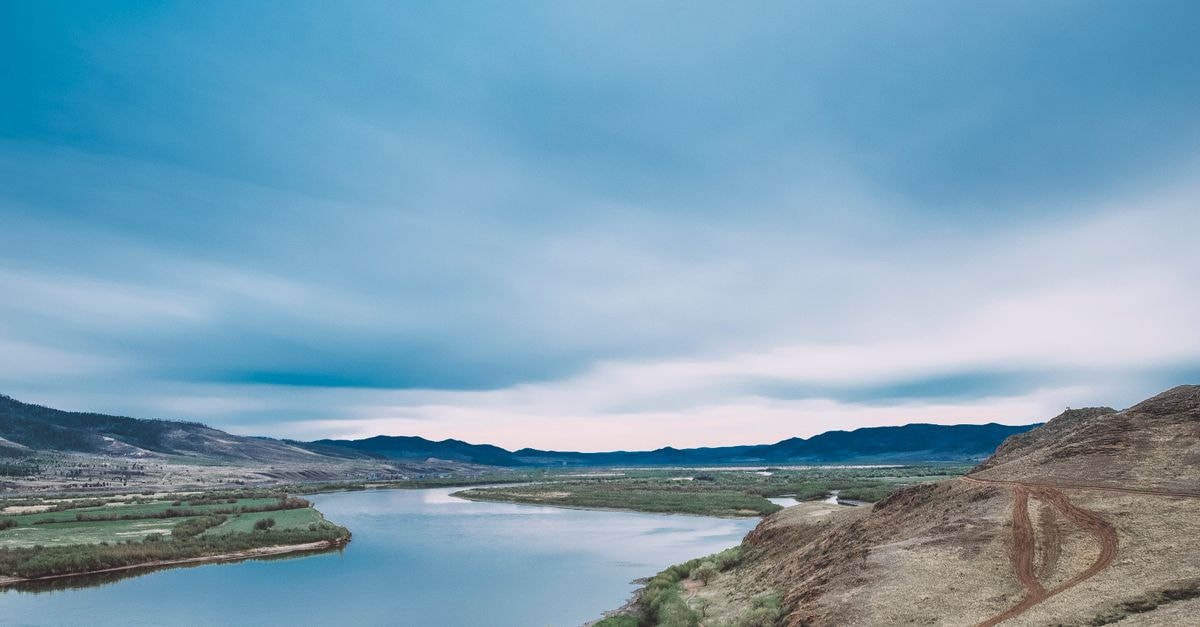
Kamloops spreads across the meeting point of two rivers in south-central British Columbia, sitting in a dry bowl of grassland ringed by hills and sagebrush. The city has a relaxed, outdoorsy rhythm that suits travellers who would rather walk a quiet ravine than chase a long checklist of attractions. There is no need to dress it up as hidden or underrated; the appeal is simpler than that, built around long light, easy trailheads and the feeling of the interior plateau opening up around you.
Climate and how it feels through the year
Kamloops sits at about 345 metres above sea level in the America/Vancouver time zone, and the city is described as arid, which already says something about how a day here can feel (F1-1). Arid in this part of British Columbia tends to mean clearer skies, cooler evenings and a wide swing between what the sun does and what the thermometer does after dark. Because the climate leans dry, you can spend a full day outside without the heavy, humid air that visitors sometimes expect further west on the coast.
The main thing to know about the busier stretches of the year is that early August brings the British Columbia Day long weekend, which lands in peak tourism season for Kamloops (F2-2). Higher accommodation costs and busier trails are typical in that window, particularly on the mountain biking networks around the Kamloops Bike Ranch (F2-2). Outside of that peak, the trail networks and the city generally feel more breathable, with parking easier to find and mornings calmer at popular trailheads. Pack layers rather than betting on a single temperature, and plan a slower first day to read the air and the altitude before heading into longer routes.
Trails, ravines and getting around on your own two feet
The defining layout fact about Kamloops is that the city sits inside a ring of hills, so hiking and backcountry trails fan out in nearly every direction (F4-1). That geography makes a rental car or a bicycle especially practical, although plenty of visitors are content exploring on foot from a central base. Trails close to town read well on a short stay, while longer routes head up into the surrounding grasslands and ridges for anyone with a full day to spare.
If you prefer staying in the middle of the city, Peterson Creek Park runs along a wooded ravine right in central Kamloops, with a paved multi-use path that passes the Peterson Creek Falls (F4-2). The paved surface suits travellers who want a gentle, flat walking loop rather than elevation gain, and the ravine setting gives shade and a sense of being out of town even though you have not left it. It works as an easy morning walk, a cool-down after a longer day on the hills, or the main outing for anyone travelling without their own vehicle.
For travellers who like to choose their own pace, the combination of a central paved path and a perimeter of trails means you can match the day to your energy level. If you prefer pure walking and natural shade over climbing, starting at Peterson Creek and finishing with a relaxed lunch in town fits naturally. If you prefer longer days and elevation, the surrounding hills open straight out of the city; a basic rental car or a rideshare extends your range considerably, while a road bike works for moderate loops between trailheads.
Food and the wider Canadian context you may encounter
Kamloops does not have a single signature dish the way some cities do, which makes the food scene feel more like a plate of what's grown, ranched or foraged nearby than a fixed menu. Because the city sits in a dry interior valley, menus tend to lean toward beef, root vegetables, Okanagan fruit in season, and baked goods that draw on prairie and ranch traditions. Travellers used to coastal British Columbia's seafood-heavy kitchens often notice the shift right away, and it is part of what gives the interior its own identity.
Looking at the wider country you are visiting, Canada has long wrestled openly with the question of what its national food might be, and that conversation itself is part of how Canadians think about their own kitchens (F5-1). It is a useful frame for visitors, because it signals that eating here is often about regional pride rather than a single headline dish. You will find that pride at the local level: a ranching-area steak, a bakery's interpretation of a butter tart, a regional take on smoked salmon, each treated as a small claim rather than a national brand.
Indigenous food culture is another national thread worth being aware of, as the Indigenous Peoples in Canada have distinct histories, languages and beliefs that long predate the country's borders (F6-1). Across the country, Indigenous-led restaurants, caterers and food experiences have been growing, and visitors are increasingly meeting First Nations flavours and techniques in cities of every size. In an interior city like Kamloops, that context may show up on a menu, at a cultural centre, or in a seasonal market, and it is worth approaching with the same curiosity you would bring to any regional cuisine.
Treat the country-level notes above as background that may colour what is on your plate, not as a checklist of specific Kamloops venues; the city itself is best explored by asking locally where the current kitchen you should try might be.
Choosing what fits your trip
The shape of a good Kamloops day depends less on how many sights you tick off and more on how you want to spend your legs and your light. If you prefer a gentler pace, base yourself centrally and build the day around the Peterson Creek ravine path, leaving the surrounding hills for a half-day rather than a full push. If you prefer bigger days and don't mind driving, the ring of hills means you can pick a different trailhead each morning and rarely repeat terrain. Travellers who like shoulder-season quiet will likely appreciate the calmer trailheads and easier parking outside the August long-weekend window, while those who travel specifically for community energy may actively want that busier peak. Visitors with limited mobility should note that the central Peterson Creek loop is paved and level, while the hillside trails are likely to involve steeper gradients and uneven surfaces, so match the route to the day rather than the other way around.
A short verification note: trail conditions, local closures and seasonal access on BC's backcountry network can change, so check the current situation with the relevant land manager before heading out, and confirm any specific venue details directly with the operator before you go. Factual travel conditions shift over time, and official channels remain the most reliable source right before you travel.
Share this article
TOOLS FOR THIS PLAN
Make the Kamloops plan measurable
Choose a tool only when it answers the next question in your trip. Your values stay in the browser, and each tool offers a route back to this planning context.